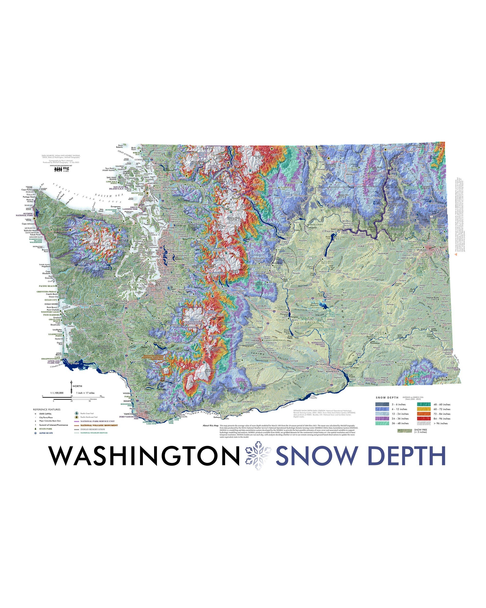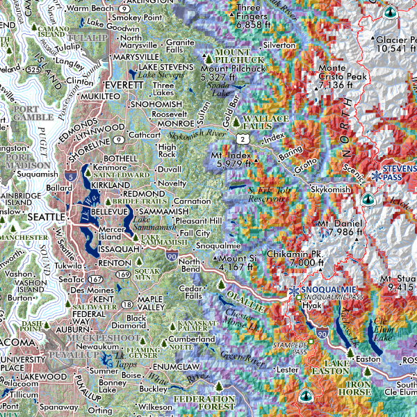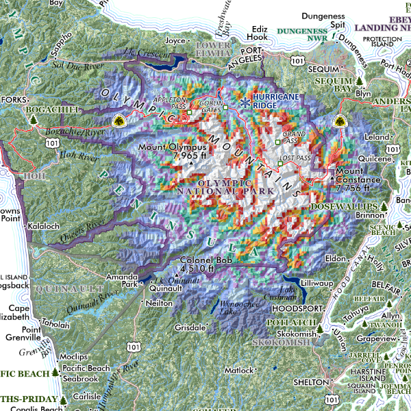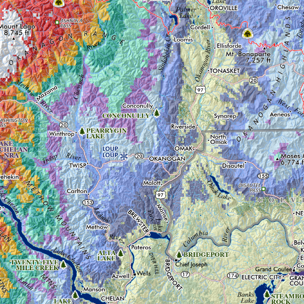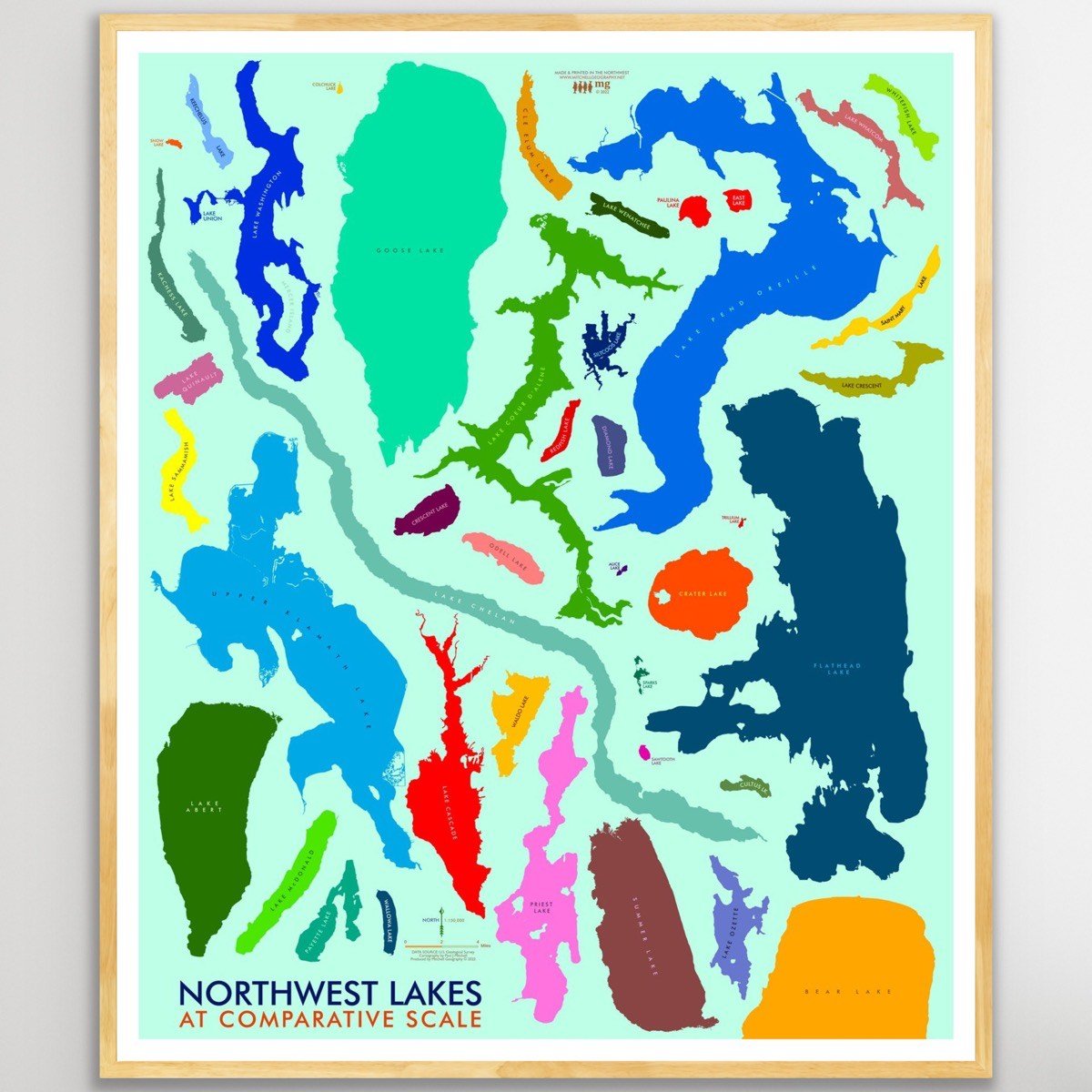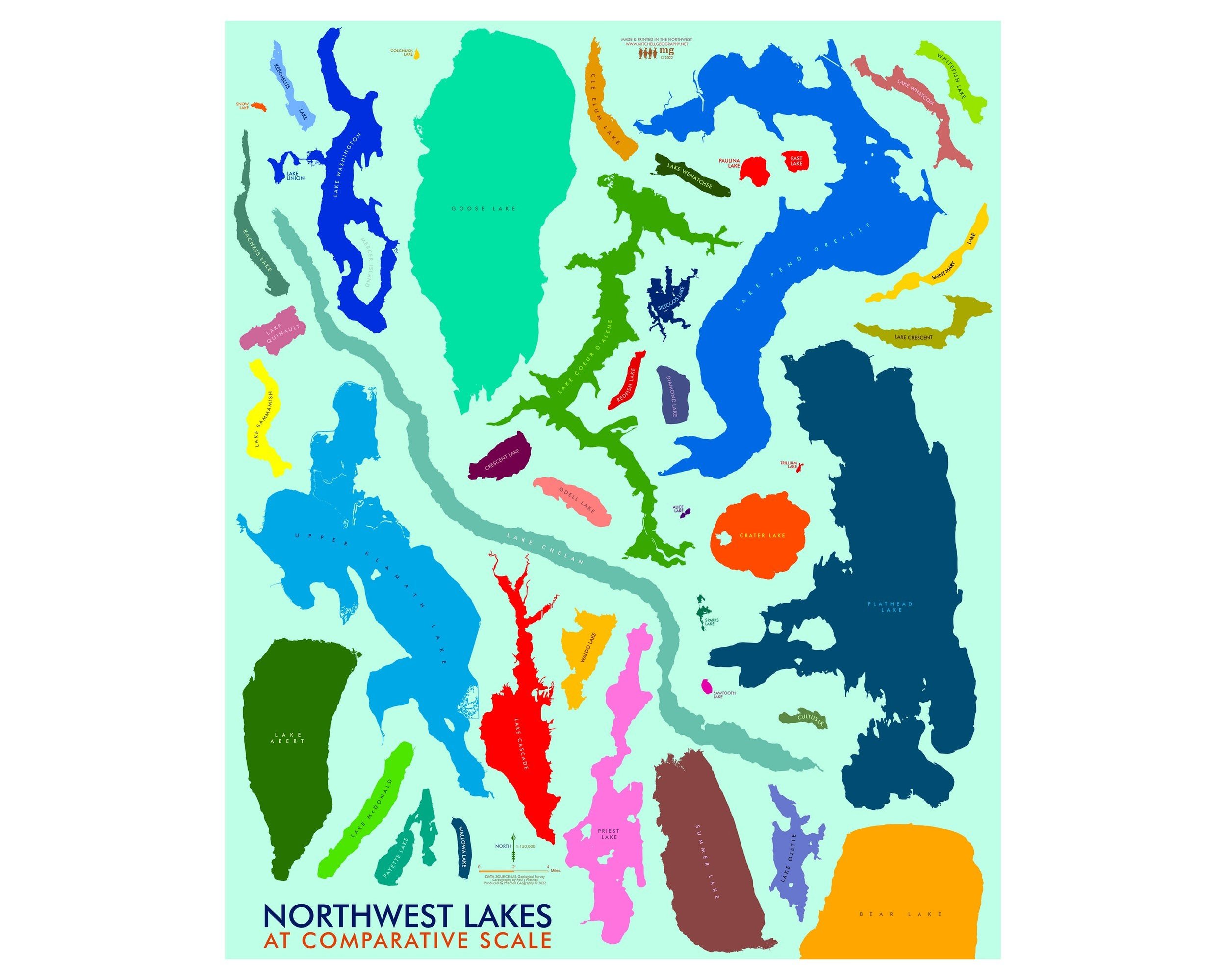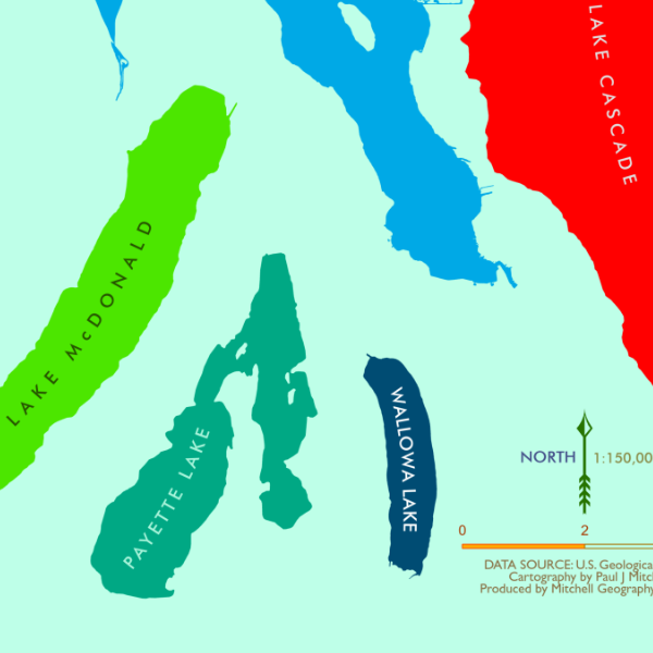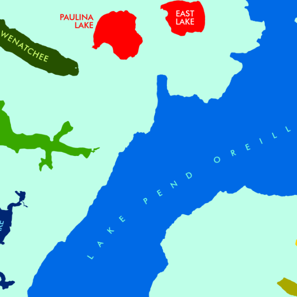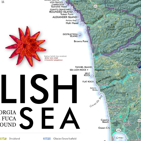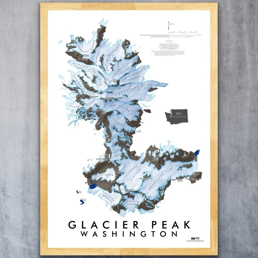


Glacier Peak Washington (19 x 13 inch version)
1:27,750
13 inch by 19 inch flat wall map, printed on heavy fine paper. Packed and shipped flat.
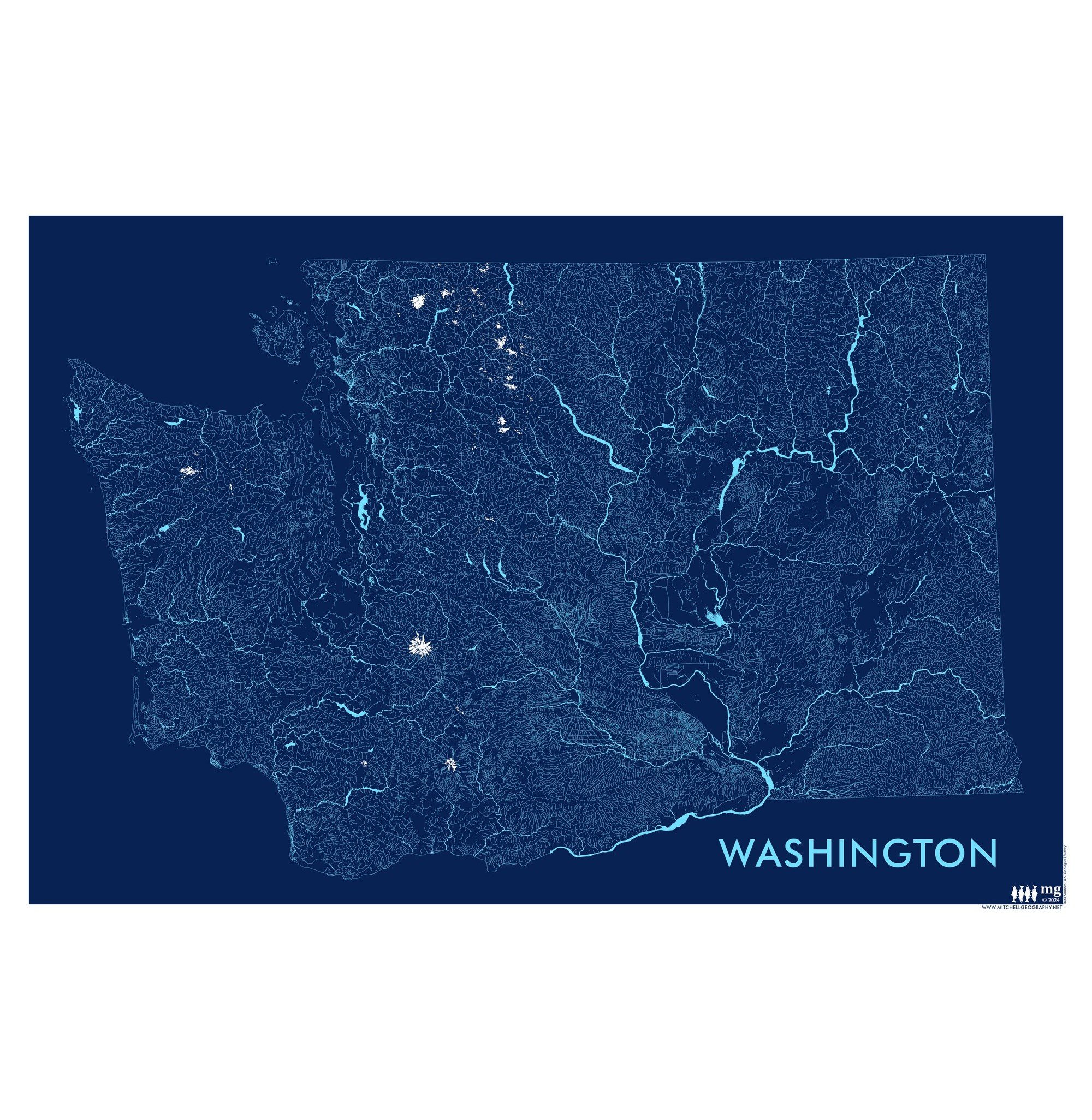
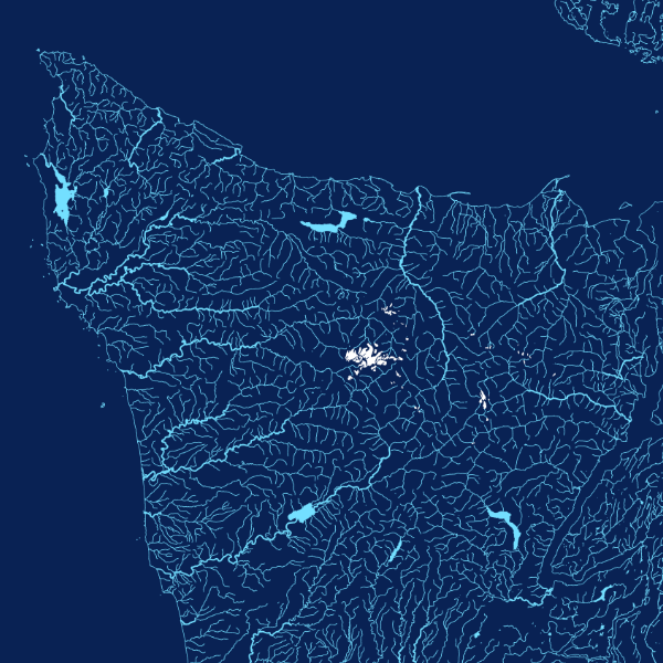
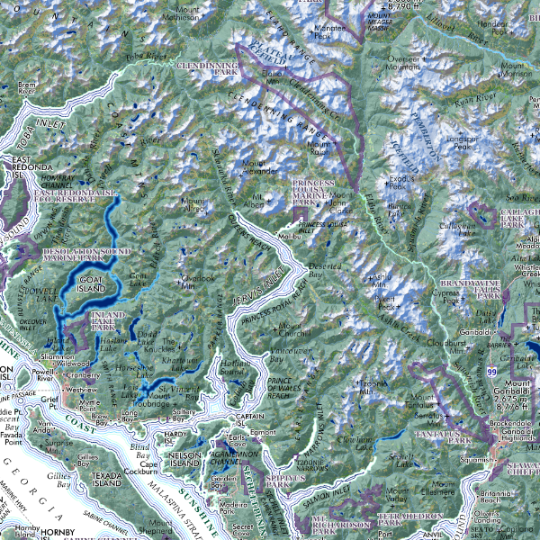
Glacier Peak, Washington (13 x 19 inch version). Feature map of the alpine landscapes of Glacier Peak south to the Kololo Peaks, including the glaciers, large snowfields and glacier remnants delineated with Washington State’s DNR published 3 foot lidar bare earth model.
1:27,750
13 inch by 19 inch flat wall map, printed on heavy fine paper. Packed and shipped flat.
Glacier Peak, Washington (13 x 19 inch version). Feature map of the alpine landscapes of Glacier Peak south to the Kololo Peaks, including the glaciers, large snowfields and glacier remnants delineated with Washington State’s DNR published 3 foot lidar bare earth model.