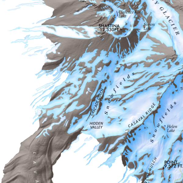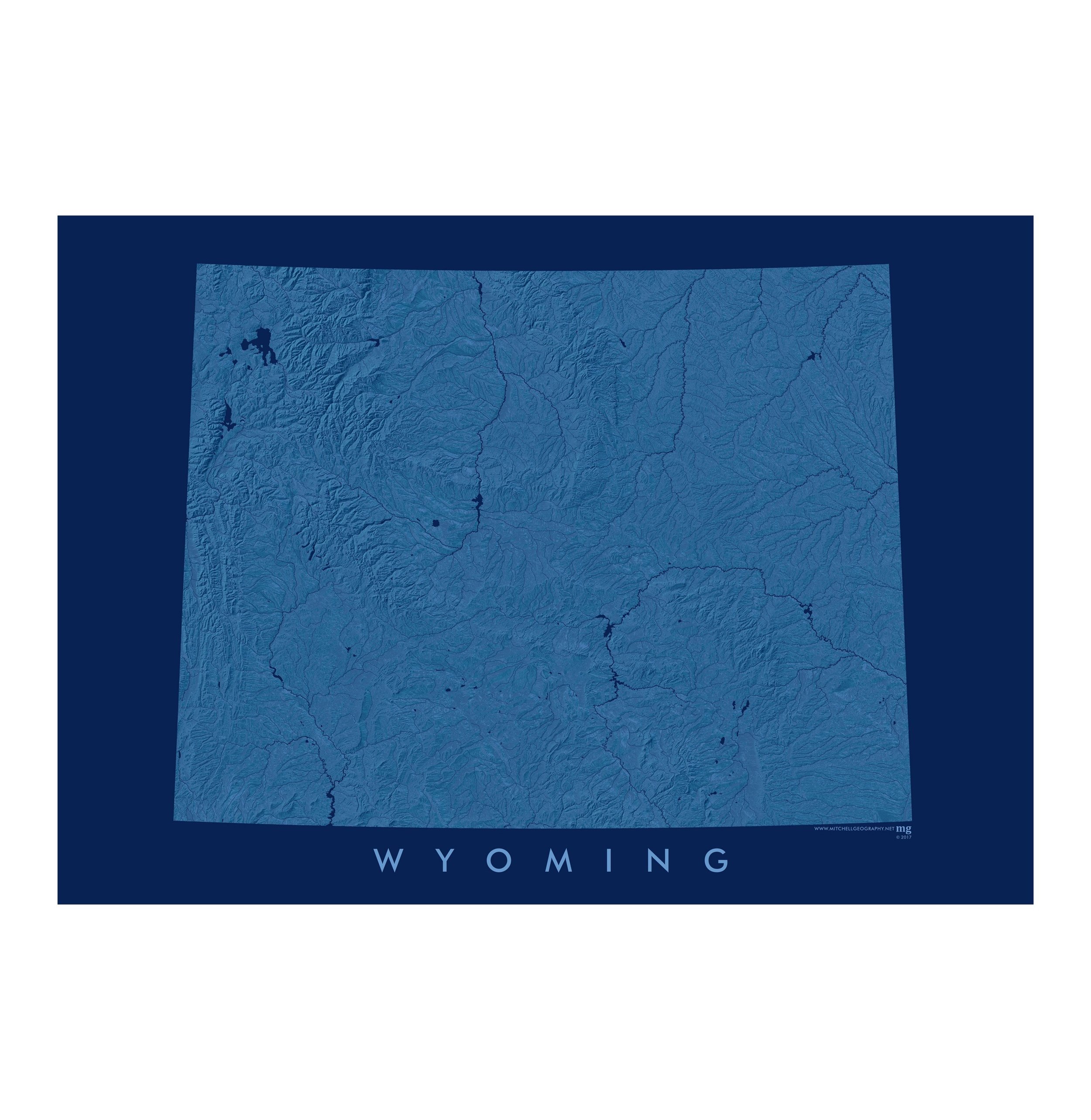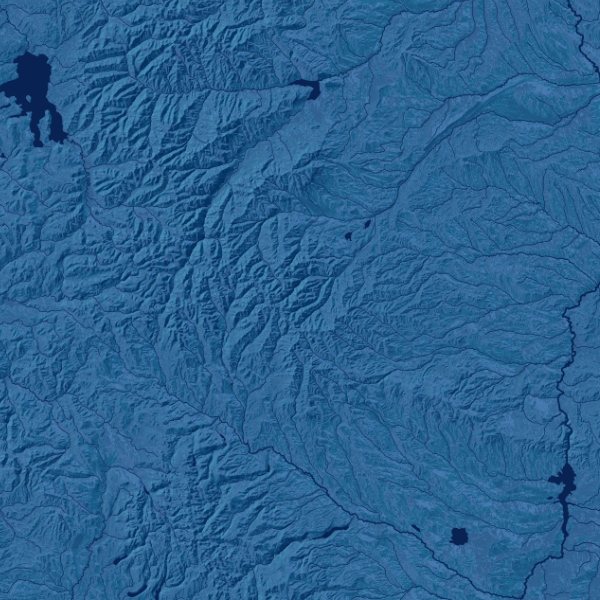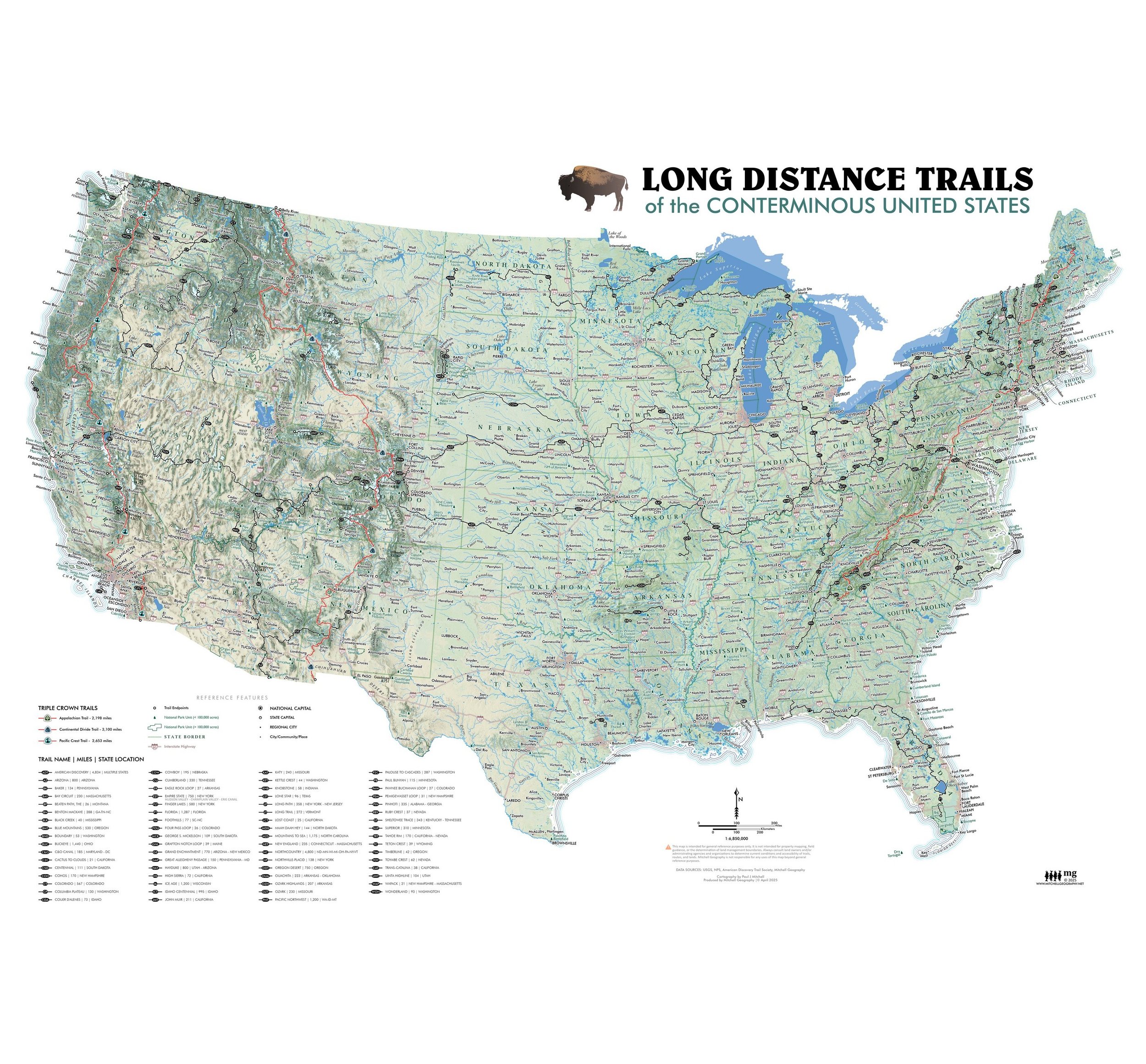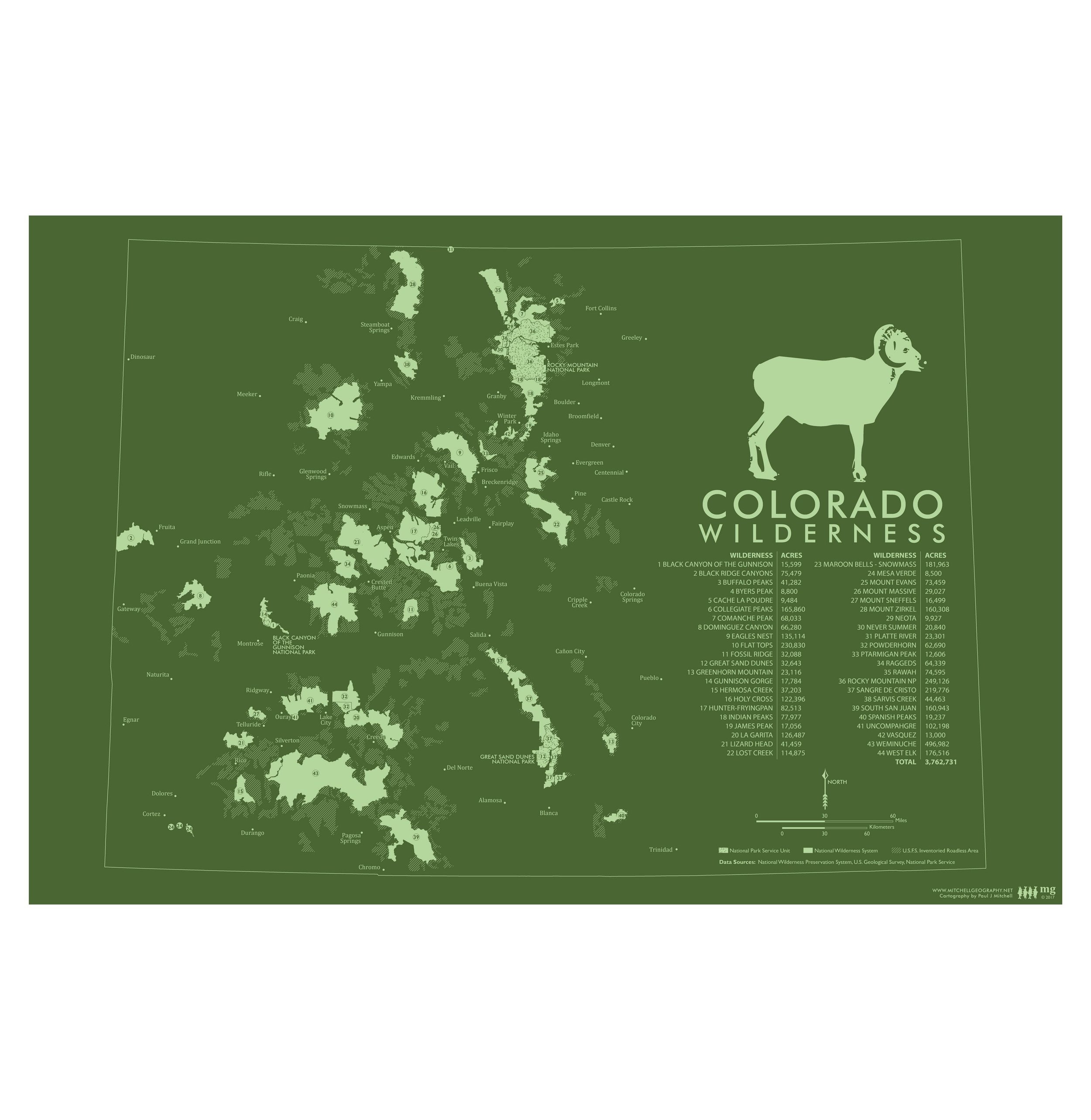

Colorado Wilderness
19 inch by 13 inch flat wall map, printed on heavy fine paper. Shipped rolled or flat, order volume dependent.
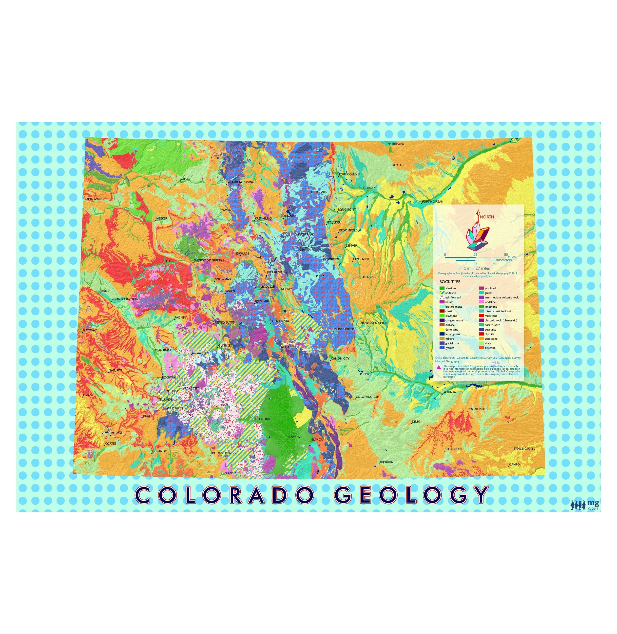
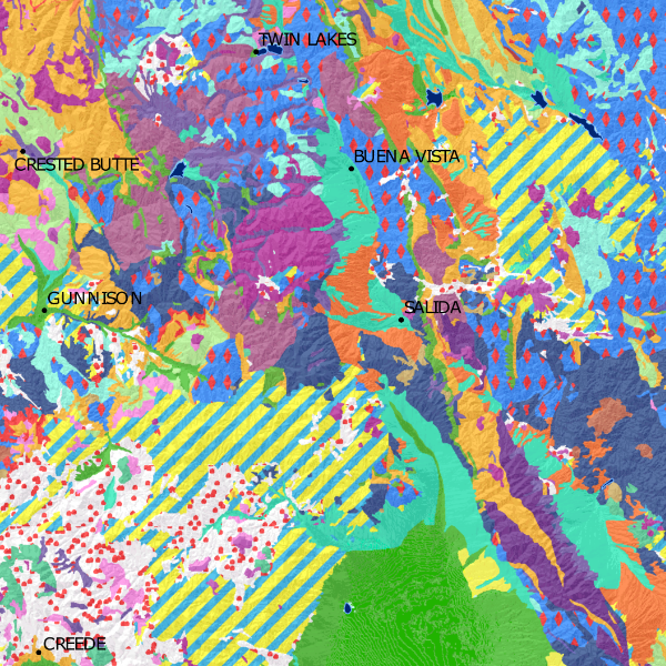
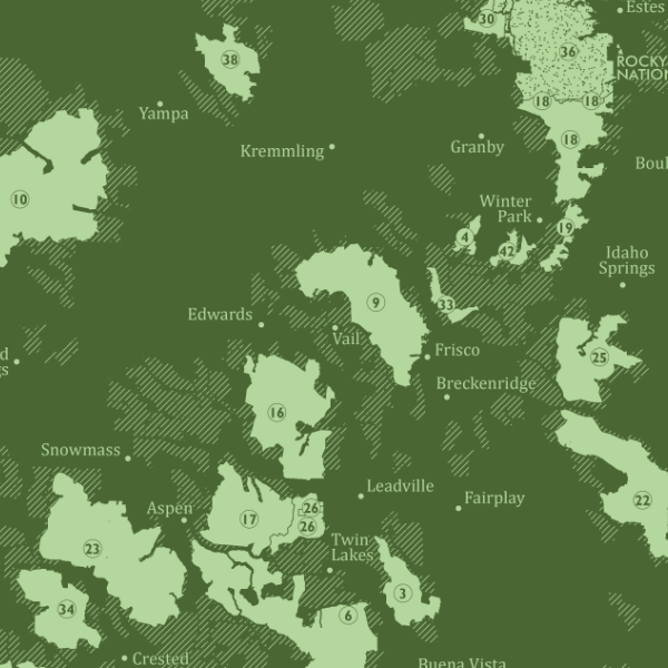
Colorado Wilderness. Vintage inspired green monochrome statewide map of Colorado federal wilderness areas. This map includes a current delineation of federal wilderness and U.S. Forest Service Inventoried Roadless Areas. A table summarizing the acreages of Colorado's designated wilderness is included for reference.
19 inch by 13 inch flat wall map, printed on heavy fine paper. Shipped rolled or flat, order volume dependent.
Colorado Wilderness. Vintage inspired green monochrome statewide map of Colorado federal wilderness areas. This map includes a current delineation of federal wilderness and U.S. Forest Service Inventoried Roadless Areas. A table summarizing the acreages of Colorado's designated wilderness is included for reference.