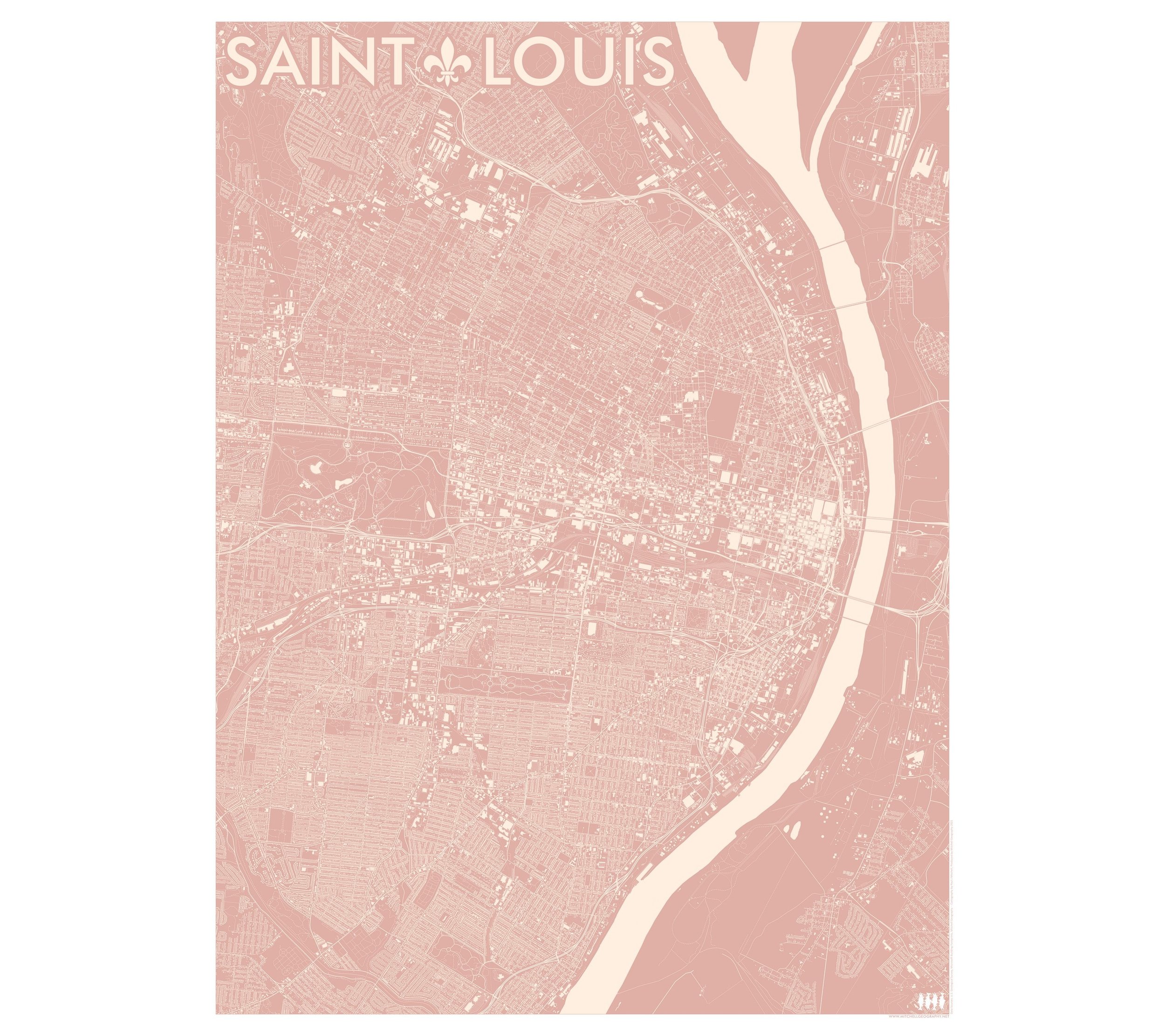
Boone - North Carolina High Country (24 in x 20 in)
1:100,000
20 inch x 24 inch — flat wall map, printed on a heavy fine paper — shipped rolled.
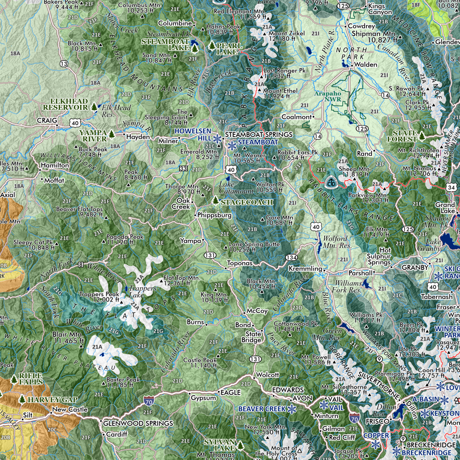
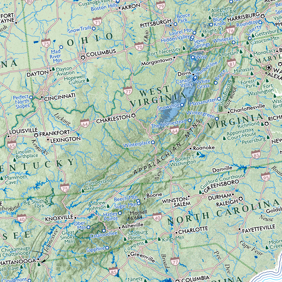
Boone, North Carolina. A fairly detailed regional general reference map of the Boone NC High Country, along with it’s surrounding towns and topographic features (including the Mountain City corner of Tennessee).
The map extent stretches in the northeast from the West Jefferson/Jefferson area down to the Linville/Newland/Crossnore vicinity in the southwest. Centered upon Boone, the map includes the surrounding Amphibolite Mountains (aka Northern Peaks - i.e. Rich Mtn, Snake Mtn, Elk Knob, The Peak, Three Top, Bluff, Mt Jefferson), the Blowing Rock vicinity, Foscoe, Linville, Newland, Valle Crucis, Banner Elk, Beech Mountain, Sugar Mountain, Grandfather Mtn., Sugar Grove/Cove Creek Township, the Watauga River Gorge, Todd, Meat Camp, Creston, and sloping southeast off the Blue Ridge escarpments to Wilson Creek, Buffalo Cove, and bottoming out at the Yadkin River valley.
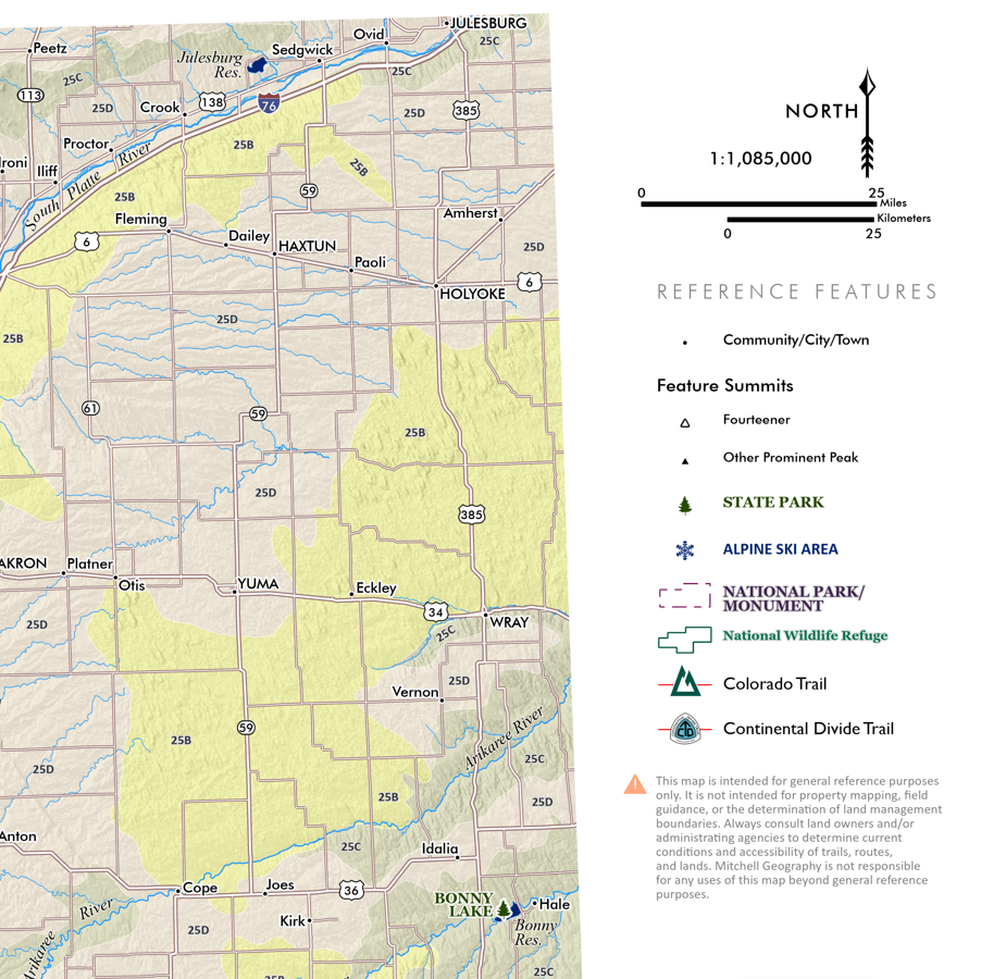
Place and reference names include towns, rural communities, mountain summits, gaps, major roads, highways, the Blue Ridge Parkway, major rivers, lakes, County boundaries and County names. Features of interest include State Park/Game Lands/special natural areas, NPS park lands surrounding the Blue Ridge Parkway, local parks/open spaces, winter recreation areas, golf courses, trailheads, and most popular trails.
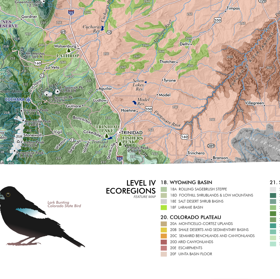
The title space includes a graphic of the Golden-winged Warbler, an endemic rare migratory bird found in the Amphibolite Mountains north of Boone.
NOT INCLUDED: Linville Gorge, Roan Mountain are not within the map area. Due to the scale of this map and the large area included, only major/primary features are typically labeled.
*Living in Boone in the late 90’s for school were some of the best years of my life. I finished with a MA in Geography at Appalachian State University in 2000.
1:100,000
20 inch x 24 inch — flat wall map, printed on a heavy fine paper — shipped rolled.
Boone, North Carolina. A fairly detailed regional general reference map of the Boone NC High Country, along with it’s surrounding towns and topographic features (including the Mountain City corner of Tennessee).
The map extent stretches in the northeast from the West Jefferson/Jefferson area down to the Linville/Newland/Crossnore vicinity in the southwest. Centered upon Boone, the map includes the surrounding Amphibolite Mountains (aka Northern Peaks - i.e. Rich Mtn, Snake Mtn, Elk Knob, The Peak, Three Top, Bluff, Mt Jefferson), the Blowing Rock vicinity, Foscoe, Linville, Newland, Valle Crucis, Banner Elk, Beech Mountain, Sugar Mountain, Grandfather Mtn., Sugar Grove/Cove Creek Township, the Watauga River Gorge, Todd, Meat Camp, Creston, and sloping southeast off the Blue Ridge escarpments to Wilson Creek, Buffalo Cove, and bottoming out at the Yadkin River valley.
Place and reference names include towns, rural communities, mountain summits, gaps, major roads, highways, the Blue Ridge Parkway, major rivers, lakes, County boundaries and County names. Features of interest include State Park/Game Lands/special natural areas, NPS park lands surrounding the Blue Ridge Parkway, local parks/open spaces, winter recreation areas, golf courses, trailheads, and most popular trails.
The title space includes a graphic of the Golden-winged Warbler, an endemic rare migratory bird found in the Amphibolite Mountains north of Boone.
NOT INCLUDED: Linville Gorge, Roan Mountain are not within the map area. Due to the scale of this map and the large area included, only major/primary features are typically labeled.
*Living in Boone in the late 90’s for school were some of the best years of my life. I finished with a MA in Geography at Appalachian State University in 2000.